

MAPS

Outlying Townlands

Topographic Ordnance Survey map from 1862

The many Nenagh Lanes as marked below - (O.S.I.)


....... added to this list is Heneys Entry in Barrack St
Clarkes Lane....Slaters Directory 1846 - according to Rates Book for 1846, this was off Norbury Lane
Hanly Place aka Bowlers Lane
Sylvester Row - bottom of Spout Road - no longer exists

Nenagh Town Plan 1840 - (M.D. Gleeson)

Nenagh Town Plan 1904 - (M.D. Gleeson)

Silver St 1888 - 1913

Silver St Old Barracks & Lewis Lane, Lewis Lane originally MacAfee's Lane after an Ulster man

Johns Lane 1888 - 1913
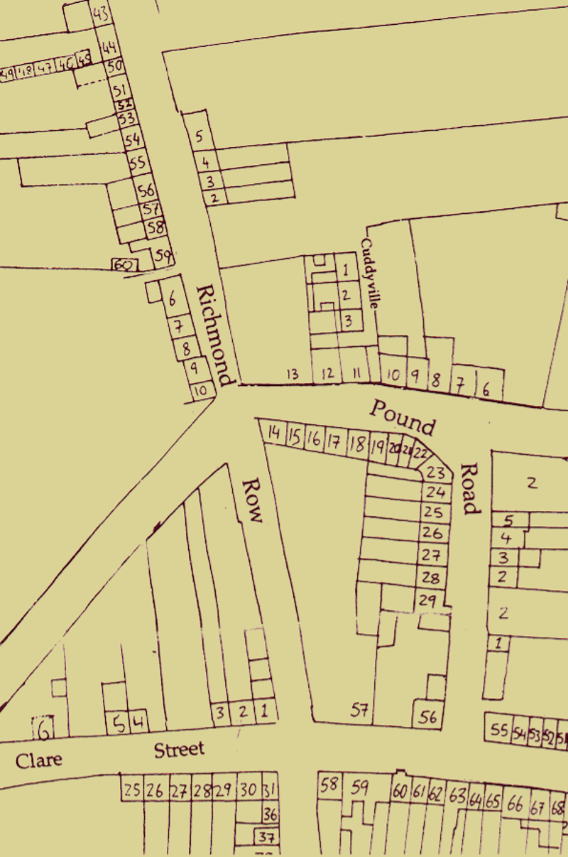
Pound Road & Richmond Row

Hanley's Lane

Norbury & Dwyers Lane before Bank Place -1846

Johns Lane

Ballalley & Glebe Lanes - (1850) - (Originally known as Allens Garden, part of a large house owned by Richmond Allen)

Before the Railway came there was Church St where the railway Bridge is now.

Nenagh from KH-9 satellite taken during the Cold War on 15/04/1974
Create Your Own Website With Webador